Nateva supports study aimed at closing wildfire data gap
An innovative local study aimed at improving wildfire management and preparedness is getting on-the-ground support from Nateva’s land management team.
The three-year Bioeconomy Science Institute Maiangi Taiao study, in collaboration with NASA’s Ames Research Center, the Australian National University, the US Forest Service and Fire and Emergency NZ, is designed to develop near real-time models of vegetation fuel moisture and fuel type.
Bioeconomy Science Institute fire ecologist Shana Gross says this will fill a significant gap in current data and ultimately support the development of more accurate predictions about wildfire risks and fire behaviour.
More accurate predictions
“If you look at the data for when we evaluate fire hazard and risk, we have pretty good weather data, we have really good topography data, but we don’t have great fuels data,” says Shana. “So it’s the missing link to be really prepared to understand fire hazard and fire risk.”
“Our goal is to use satellite data to develop a fuel moisture model. We’re also looking at creating a fuel type model that we can link directly to our fire behaviour models.”
The project will use high resolution satellite imagery to cover a large area, calibrated against simultaneous measurement of live vegetation fuel moisture and atmospheric data on the ground. The project includes three vegetation types that pose a wildfire risk across New Zealand: grass, shrub (manuka/kanuka) and conifer tree species. Pinus radiata has also been included to ensure the modelling has practical applications for managed forests in New Zealand.
Because fuel moisture levels change rapidly, teams around the country will time their collection of moisture samples to coincide with frequent satellite overpasses, collecting samples twice per month in the summer and monthly in winter.
“The satellites see different wavelengths of light reflecting back,” Shana says. “So we will build these models to correlate those readings to dryness or wetness, based on the colours.”
New Zealand has become a case study for project partner NASA Ames, because it offers so much variability in fuel type and topography.
“It can be applied to other places and has even drawn attention from Hawaii, which is also developing a fuel-type model.”
On the ground measurement
The data on the ground is being collected from a broad range of environments across the country where the target vegetation is present, including in sites across Nateva’s permanent conservation estate.
“Nateva is so far the only company that has said it will collect the data,” Shana says.
Nateva Land Managers Jymahl (Jimmy) Glassey and Cam Davies are managing the project on-site for Nateva. Jimmy’s area of responsibility includes a large forest near Pongaroa in the Tararua district, selected for the project due to its scale, while Cam is surveying across four forests in Taranaki chosen for their varied topography – ranging from near sea-level to 350m and warmer climate.
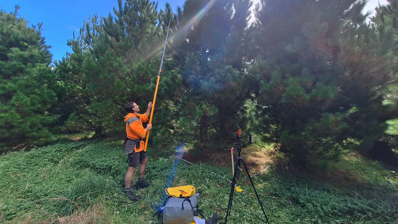
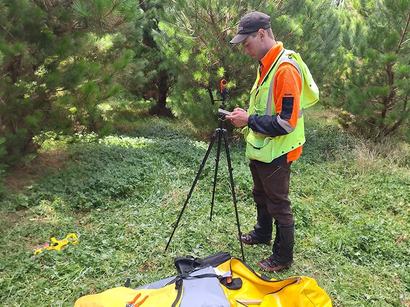
Working with the Nateva team, Bioeconomy Science Institute researchers have established two 10x10m2 plots at each site, which are precisely mapped and geolocated. Nateva will collect the samples from each plot – four from ground foliage and four from the trees, timed to coincide with satellite overpasses. A ‘Kestrel’ device is used at each sampling point to concurrently measure humidity, air moisture and wind direction.
Making a difference
Jimmy says the team is excited to contribute to tools that could make a real difference in predicting fire risk.
“If we can get some really good data that helps predict and subsequently prevent any fires, it’s got to be better than just casting an eye over it and saying, ‘it’s windy, it’s dry’. With this kind of monitoring, we can predict that stuff well before we see it,” says Jimmy. “On the ground, that means we can take a lot of alternative action to reduce any fire risk from work around the site.”
Cam says the research should also help foresters and rural communities manage the high level of variability across the local landscape.
“It’s very site-specific,” says Cam. “For example, this year has been a very damp summer, with some parts of the region experiencing massive flooding. And yet there are areas just an hour away that have only had 15mms of rain. This should help understand that difference.”
Both Land Managers agree contributing to the project could provide some vitally important tools, not just for Nateva to use in their own forest stewardship, but for the wider rural community.
“To have scientific data we haven’t had before could make a real difference,” says Jimmy. “So it’s a good thing to be involved in, especially if it is helping create a good product at the end.”
Cam says while the project is quite unique, the work is being incorporated into Nateva’s active management approach. “We’re in the forest actively working on its growth and development. This is another tool we can use to help us plan our work, and long-term, build our understanding of forest health.”
Tangible outputs
Shana says the project is expected to produce a variety of tools, including near real-time spatial datasets showing fuel moisture, updated every 3-5 days, allowing users to visualise dry versus wet areas.
“The long-term goal is to integrate those with our fire spread models,” says Shana. “So if there is a fire, we can pull out this fuel moisture data and put that directly into the fuel model. Hopefully we can link that with the fire danger ratings as well. Before starting the project, we wanted to make sure there are actually tangible outputs people could use.”
Beyond fire risk, the fuel moisture data could also serve as a drought and forest health indicator. By identifying trends and anomalies in moisture levels, forest managers could detect stressed stands, anticipate pest issues, and inform planning for restoration projects, such as Nateva’s actively managed restoration from exotic to native forests.